Typhoon "Hualien" Approaches South China,CILF Postponed
2025-09-23
Super Typhoon "Hualien" Approaches South China: Multiple Regions Activate Emergency Response
Typhoon No. 18 "Hualien" intensified into a super typhoon on the morning of September 21, with peak winds reaching 62 m/s (Category 17). As of 5:00 AM on September 22, its center was located approximately 590 kilometers northeast of Manila, Philippines, moving westward at about 20 km/h with stable intensity.
"Hualien" passed through the Bashi Channel on September 22 and entered the northeastern South China Sea in the early hours of September 23, gradually approaching the coast from central-western Guangdong to northeastern Hainan Island. Its intensity is expected to weaken slightly. The typhoon is likely to make landfall between the early hours and afternoon of September 24, from Shanwei, Guangdong, to Wenchang, Hainan, with an estimated intensity of severe to super typhoon strength (Category 14-16).

Significant Wind and Rainfall Impacts: High Risk of Disasters
From September 22 to 25, Guangdong, Guangxi, and other regions will experience severe wind and rain. Specifically, from September 23 to 25, coastal and inland areas of Guangdong will face serious impacts, with localized extreme heavy rainfall. Winds in the northern South China Sea and Bashi Channel are expected to reach Category 10-17, with gusts exceeding Category 17.

Port and Terminal Operations Adjusted
To mitigate the typhoon’s impact, multiple terminals in Guangdong have adjusted their operations:
1.Nansha Phase II and III Terminals of Guangzhou Port: Ceased gate container return operations at 04:00 on September 22; fully suspended gate services at 12:00 on the same day.
2.YICT, SCT, CCT, MCT: Fully suspended gate operation services at 00:00 on September 22.

CILF Postponement Notice
Due to the impact of Typhoon "Hualien," the originally scheduled Shenzhen International Logistics and Supply Chain Expo (CILF) has been postponed to September 25–27. Exhibitors and visitors are advised to stay updated on the latest arrangements and prioritize travel safety.

We warmly welcome you to visit our booth during the event for face-to-face discussions and collaboration opportunities!


Precautionary Recommendations
Meteorological authorities advise:
1.High alert for potential disasters caused by strong winds and heavy rainfall in the northern South China Sea and South China regions.
2.Maritime units should strengthen inspections of protective facilities such as seawalls and prepare for storm surges and high waves.
3.The public should avoid coastal danger zones, closely monitor weather warnings, and take preventive measures such as reinforcing doors/windows and preparing emergency supplies.
END
Disclaimer: This content is for reference only. Please refer to official announcements from the China Meteorological Administration, China Weather Network, Guangdong Meteorological Bureau, Guangzhou Daily, and other authorities for the latest updates. For any concerns regarding content infringement or copyright, please email admin@mbs-gz.com for prompt handling. Thank you.
Recent news
View all news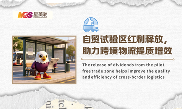
The release of dividends from the pilot free trade zone helps improve the quality and efficiency of cross-border logistics
In 2026, the institutional opening-up of the pilot free trade zone will continue to deepen, and the growth rate of foreign trade economy will be impressive, while the vitality of the industry will continue to rise. The policy dividends continue to empower the upgrading of cross-border logistics industry, providing strong support for foreign trade enterprises to speed up their overseas expansion, reduce costs and increase efficiency.
Learn more> >
AI empowers shipping! Chinese ports enter a new stage of intelligence
With the deep empowerment of digital technologies such as artificial intelligence and big data, China's port and shipping industry is accelerating iterative upgrading.
Learn more> >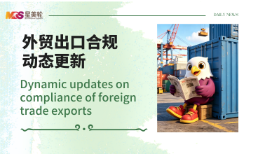
Dynamic updates on compliance of foreign trade exports
In the middle of the year, multiple countries and domestic trade policies were implemented, and new regulations on chemical control, customs inspection, destination country access, and import tax exemption came into effect simultaneously, covering many popular export goods such as chemical intermediates, electrical appliances, new energy buses, paints, etc.
Learn more> >
Attention! Latest adjustment of the control catalog for precursor chemicals
Recently, five departments including the Ministry of Commerce and the Ministry of Public Security jointly issued a notice to adjust the "Catalogue for the Management of Exporting Precursor Chemicals to Specific Countries (Regions)", adding three new categories of controlled chemicals and clarifying differentiated export permit requirements for six key countries.
Learn more> >Consultation & Suggestions
If you have logistics consulting or cooperation intention, please leave your message here,
or put forward your valuable comments or suggestions, we will contact you at the first time.